


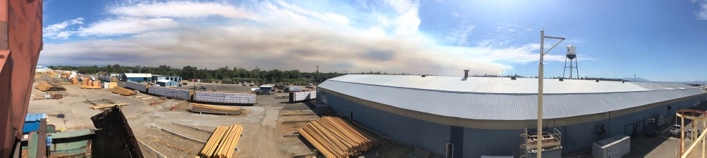
We awoke this morning to what we thought was another day of cloud cover. When we went out to air the dogs it was still dark and we could see an orange glow to the Southwest. We climbed into the truck to investigate only to discover it was far to the Southwest. When the morning light brightened the sky we could see the orange hue of smoke filtered light and ash was on everything. A fire blew up overnight in Tehama County and the smoke covered Shasta County by morning. It seems folks all over California woke up to the same and worse conditions. CalFire named this one the 3-4 Fire. Last count had it at 1,000 acres. It’s not the biggest fire. There’s one far worse threatening Vacaville. Say a prayer for the folks down there.


The Sacramento River Canyon caught fire today near Pollard Flat. Another fire and this one is near the Hirz Fire. This is the Delta Fire.

It started just after lunch and began building its own pyro-cumulus cloud right away. Just what we need here, another wildfire. Lamoine and other river communities are being evacuated.
I’ve taken so many picture of the sunsets during the Carr Fire. Here is another set. I took these about ten days ago. We are still getting the surreal sunsets. The fire is contained and the burnout operations are done. Other fires are burning in the area. We won’t be without the smoke anytime soon.


With all the fires burning in California there has been a lot of discussion about logging to reduce forest fuel. Doing so makes our forests more fire resilient. There is fear among many people that logging of any kind will destroy our forest. The truth is the the fires are destroying our forests. This is a short video of such a logging operation from last year on the Lassen National Forest. The Forest Service prepared this project. Our company bought and logged the timber sale. The result is a healthier more resilient forest.
Friday was another difficult day in Redding as the Carr Fire continued to spread. Overnight the fire grew toward the southwest near Igo and to the north of French Gulch.

Saturday morning
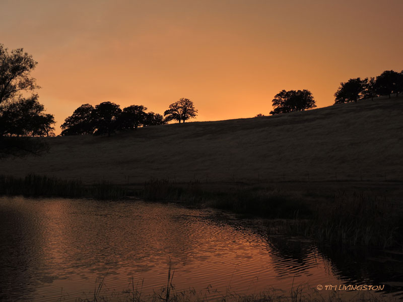
Our sky looks look toxic. Here are some views from the last two days.

The view from our backyard Thursday night
The next photos were from Friday evening.

Looking northwest, the major smoke cloud was moving east.

This was last nights view from the backyard.

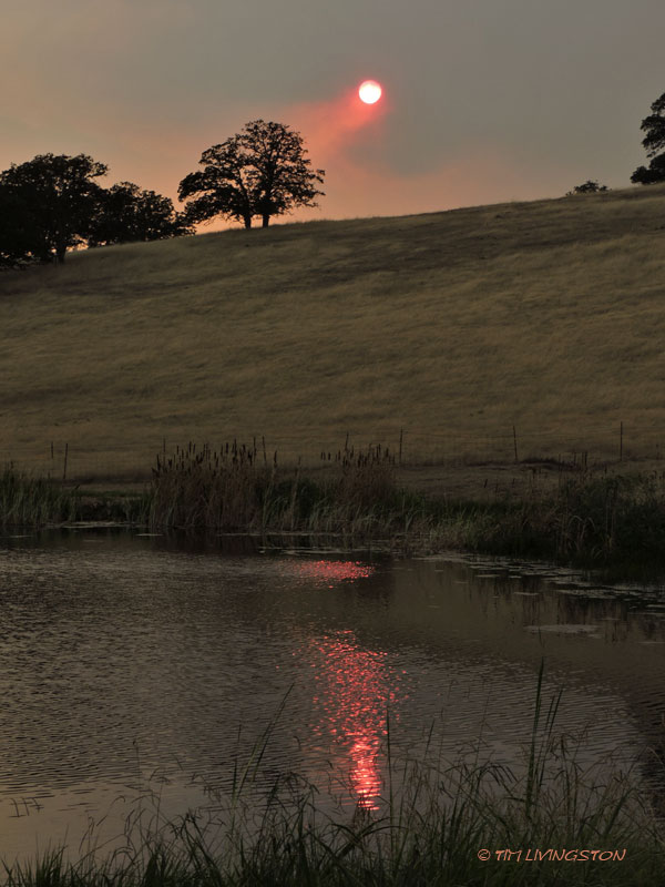
The sun.


Looking north over the pond.
This morning the sky had an apocalyptic pall over it. Colors were shifted from the smoke filtered light. Ash had fallen on our property. Now our home isn’t close to the fire. We aren’t in any danger. Most of our friends are much closer. Many have had to evacuate. With Google Earth I was able to determine that we were 22 miles from the fire as the crow flies. That’s how far the ash had traveled.


Based on latest hot spot map the fire may have spread south of Highway 299 near Redding. This is a terrible development. Hopefully the firefighters can stop the spread. Fortunately, it didn’t reach the forecast high of 113 today. It just made it to 111. Nevernind, I just found out it did reach 113.

I was in the Trinities this week and there was thick smoke everywhere. It’s burning season in Northern California. We had quite a lot of rain in late November. I assumed that some agency was doing a large burn project. However, I couldn’t see where the smoke was coming from. It appeared to be drift smoke.
During my drive down from the mountains I heard a news report. They reported that smoke from the Thomas Fire was drifting up the coast. I checked Google Earth that evening and the smoke had drifted nearly 500 miles from the Thomas Fire in Southern California to north of Redding. The residue of so many homes and so much wildland was adrift in this smoke.

The late afternoon sun filtering through the smoke in the Trinities.

Looking north toward Billys Peak across the old dredge tailings along the Trinity River.

Smoke tinted sunlight and trees reflect on an old dredge pond.
